

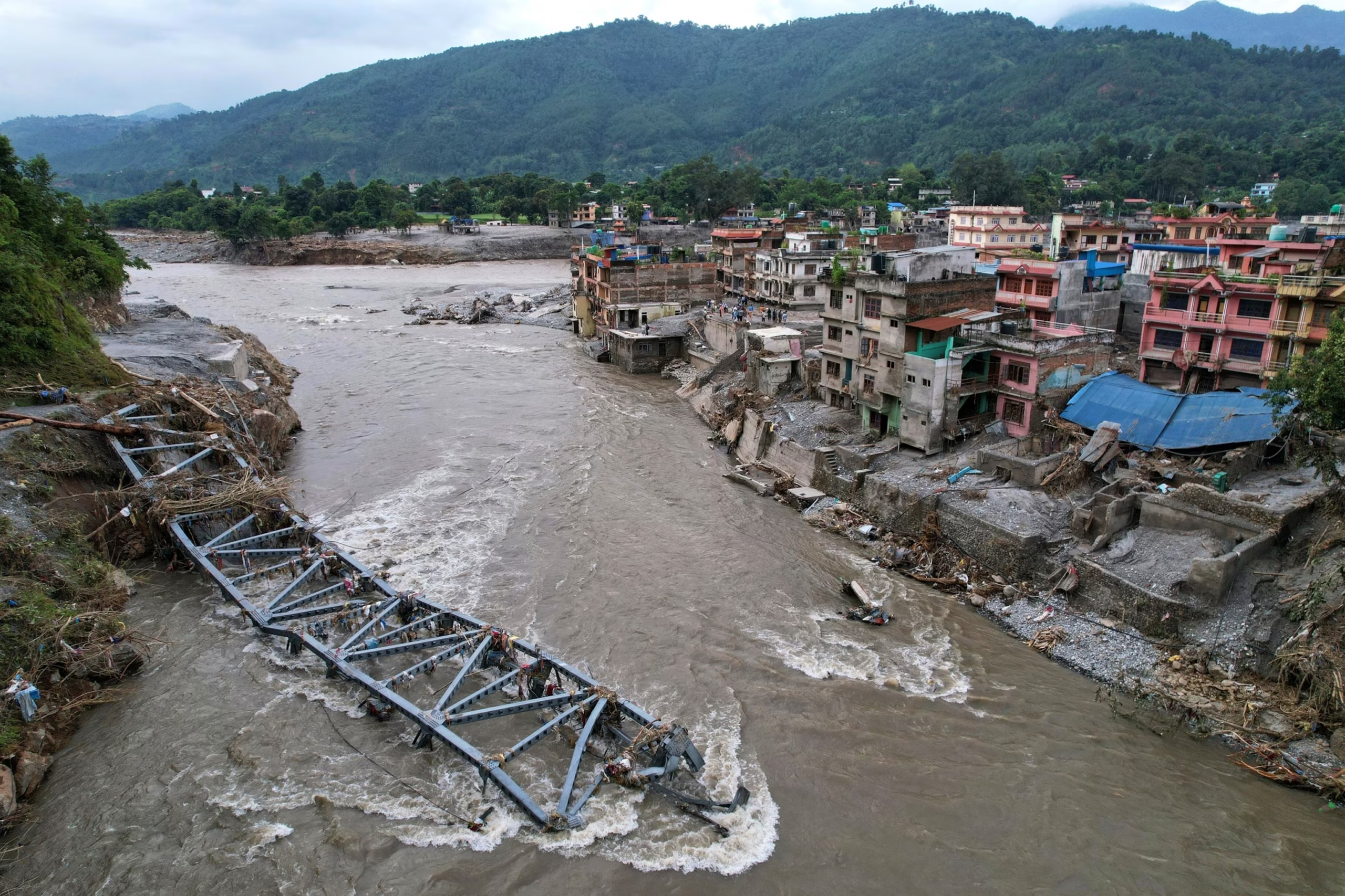
A devastating glacial landslide in the Himalayas triggered catastrophic flash floods that ravaged the Nepal-Tibet border region, leaving widespread destruction and hundreds of casualties. A massive avalanche of ice and rock unleashed torrents of mud, water, and debris into the Trishuli River—also known as the Bhotekoshi—sweeping away homes, bridges, roads, and hydropower infrastructure.
The disaster has claimed at least 389 lives in Nepal, while hundreds remain missing, including numerous foreign nationals. Across the border in Tibet’s Gyirong County, at least three people have died, and 558 people remain unaccounted for, including approximately 260 foreign nationals.
What Happened in Nepal?
At approximately 8:40 a.m. local time (02:55 GMT) on August 26, powerful flash floods and mudslides struck mountainous communities along the Nepal-Tibet border. A massive surge of water, mud, and boulders tore through the Lhende Khola River Valley, engulfing villages and destroying homes, roads, bridges, and critical infrastructure. The floods washed away at least 19 bridges and nearly 40 kilometers (25 miles) of roadway, severely disrupting transportation and rescue operations.
Nepalese authorities quickly launched emergency response efforts, deploying soldiers, helicopters, drones, and search-and-rescue dogs. However, swollen rivers, damaged roads, and unstable terrain have made access to several of the worst-affected areas extremely challenging.
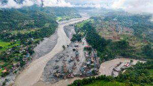
On August 28, Nepal News reported that the Nepal Army successfully rescued approximately 350 workers and residents trapped inside a tunnel at the Upper Trishuli Hydropower Project, despite hazardous weather conditions and dangerously high river flows. Meanwhile, Chinese rescue teams in Tibet have also faced delays due to deep sediment deposits blocking access to the affected border region.
What Triggered the Mudslides and Flash Floods?
The disaster appears to have originated high in the Himalayas, where a significant portion of a glacier collapsed, releasing an enormous volume of ice, water, and debris downstream. Experts from the International Centre for Integrated Mountain Development (ICIMOD) in Kathmandu reported that water levels in the Trishuli River surged by as much as nine meters within just 30 minutes. The Lhende Khola River, a tributary of the Trishuli, experienced the most severe impact.
Satellite imagery revealed that a substantial section of the glacier’s lower edge broke away at an elevation of approximately 5,200 meters (17,000 feet). The collapsing mass plunged nearly 1,200 meters (3,900 feet) into the valley below, gathering rock and sediment before striking the river.
The resulting ice-and-rock avalanche temporarily dammed the Lhende River in Tibet, roughly 20 kilometers (12 miles) northeast of the Nepal-China border crossing. When the natural barrier eventually failed, it unleashed an even more powerful flood downstream.
What Caused the Flooding?
Initial assessments from Nepal’s Foreign Minister Shisir Khanal suggested that an earthquake may have triggered a landslide that caused the flooding. However, subsequent findings by the U.S. Geological Survey (USGS) concluded that the seismic activity was itself the result of the glacier’s collapse, identifying the glacial failure as the primary cause of the disaster.

The floodwaters first entered the Lhende Khola, before flowing into the Bhote Koshi and then the Trishuli River, carrying destructive currents southward through Nepal. Water levels reportedly rose by nearly 30 feet (9 meters) in just half an hour.
Areas Most Severely Affected
In Nepal’s Rasuwa District, the towns of Timure and Syapru Besi suffered extensive damage. The flooding later spread downstream into parts of Nuwakot and Dhading districts, further expanding the disaster’s impact. Across the border in Tibet, mud and debris inundated Gyirong Port in the Shigatse region, disrupting transportation and rescue efforts. The Trishuli River eventually merges with the Narayani River, which flows into India’s Bihar state, where it is known as the Gandak River.
Regional Impact Extends Into India
As river levels continued to rise, Indian authorities evacuated thousands of residents from vulnerable areas in Bihar, Uttar Pradesh, and Uttarakhand, fearing additional flooding across the Gandak River basin. The disaster highlights the growing risks posed by glacial instability in the Himalayas, where climate change and extreme weather events are increasing the likelihood of catastrophic floods that can affect multiple countries within hours.