


Mr. Nitish Kumar, a 2014-batch Indian Forest Service (IFS) officer of the Odisha cadre, currently serves as the Divisional Forest Officer (DFO) of the Angul Forest Division. An engineer by training, with a background in Electronics and Communication Engineering from NIT Karnataka and prior experience with NTPC, he began pioneering technology-driven forestry solutions when he took charge as DFO of Kalahandi North in 2017. Over the years he has authored the book “Applications of GIS & Drone Technology in Forestry & Wildlife”, documenting the uses of drones and GIS in the field, and has earned a nomination for the Eco Warrior Awards 2026 in the Best Use of Technology category three times in a row. Driven by the philosophy that complex forest ecosystems demand real-time data for judicious decision-making, his work bridges cutting-edge innovation with traditional field management.
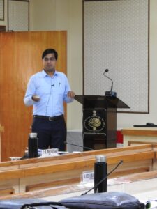
To democratize data access across every administrative tier, Kumar established a GIS-based Management Information System (MIS) portal for the Angul Forest Division. The web platform, which works much like standalone GIS software with layer-by-layer analysis, integrates spatial layers such as elephant movement, wildlife depredation, waterbodies, soil and moisture conservation structures and plantations, and is updated almost daily. Designed so that any layman can use it without learning GIS software, the portal gives login access right down to the Forest Guard at the beat level, enabling frontline staff to study spatial maps on their mobile devices before executing field interventions. GIS is also used to analyse foot-patrol routes and eliminate “grey areas” in coverage, and the results show: Angul ranks first in Odisha for cumulative forest patrolling, with 30,225 kilometres of foot patrols recorded in April 2026 and 32,816 kilometres in May 2026, both the highest in the state.
Nowhere is the challenge sharper than in human–elephant conflict. Spread across 2,909.542 sq. km, with forest cover of 1,037.512 sq. km, the division is a mosaic of forests, farmland, villages, mines and fast-growing industrial zones, and it serves as a crucial corridor for elephant movement. As per the DFO Control Room records, 127 elephants in 29 herds, including 48 males, 48 females and 31 calves, were recorded in the division as on 15 June 2026, up from an average of 118 during 2024–25. Sixteen years of monitoring data show a steady rise in elephant numbers while habitat, forage and water have stayed largely constant, pushing herds into fields and settlements. In 2025–26 alone, wild animals damaged 2,308.664 acres of agricultural land in the division, and ₹6,20,14,385 was disbursed to affected farmers under Anukampa assistance.
Kumar’s answer has been a science-based, multi-pronged strategy, anchored by four AI-enabled e-Eye surveillance towers installed across critical elephant corridors, two in Jarapada Range and one each in Talcher and Chhendipada. Standing 35 metres high, the towers carry 360-degree rotating thermal cameras with pan-tilt-zoom controls that continuously scan their surroundings, while embedded AI algorithms detect elephant and human presence and trigger instant alerts to the control room so nearby communities can be warned. The system has logged 51 elephant detection events in 2026 so far. The towers are paired with 35 thermal-imaging drones that track herds at night and through dense vegetation, and with speaker-mounted drones that broadcast warnings to villagers. The same drones calculate canopy density and generate 3D elevation maps for soil-moisture structures. A mobile network-based Early Warning System of 360 units, including 60 under installation, sends automated calls and messages to communities as herds approach, and 27 tuskers have been profiled and given unique codes such as AT1 and AT2 (“AT” for Angul Tusker). Odisha’s first elephant radio-collaring, of the Gajendra tusker on 21 February 2024, was carried out in the Angul division, marking a milestone in the state’s adoption of advanced wildlife management practices.
Technology is backed by hard infrastructure and community outreach. The division has installed over 900 high-mast lights, with 90 more in process, and 840 solar-powered street lights in forest-fringe villages, with another 95 under way, alongside 210 km of solar fencing and 26.84 km of elephant-proof trenches. An LED-mounted awareness vehicle tours villages and forest edges, and around 10,000 weather-resistant tin sheets carrying safety messages in local languages have been put up in vulnerable areas over the last year. The results are encouraging: since 2023, human casualties in the division have shown a marked decline, and incidents of crop damage, house damage and cattle loss have also fallen significantly over three years, moving Angul towards its goal of near-zero human–elephant conflict.
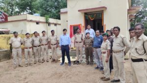
The same data-first thinking drives Kumar’s fight against forest fires. He instituted the Fire Control Rapid Response System in the Kalahandi North, Balangir and Angul divisions, subscribing to NASA’s Fire Information for Resource Management System (FIRMS), which draws on five satellite instruments compared to the three used for the Forest Survey of India alerts. Strategic fire lines were mapped along roads, nallahs, old fire lines and plantations, and GIS and historical fire data were used to place additional lines where limited resources would count most. In Balangir, the division’s share of the state’s fire points fell from 4.25% to 1.34%. In Angul, despite rapid industrialization and opencast mining, fire alerts fell from 738 in 2023 to 333 in 2026, and the area burned shrank from 157.1 hectares to 12.35 hectares.
Protection also extends to poaching and habitat. The division has introduced financial rewards and strict identity protection for anonymous informants reporting illegal snares, firearms or explosives, backed by specialized raiding teams across six forest ranges, while the adoption of root-zone irrigation, which delivers water straight to the plant’s roots, has optimized plantation survival, leading to habitat improvement and wildlife conservation. To bring citizens into the effort, Kumar introduced the “Sabuja Angul” mobile application and the division’s official website, www.dfoangul.org, letting people request seedlings, log pollution complaints and report illegal tree felling or poaching anonymously through photos, videos or text messages, while also improving staff coordination and wildlife rescue logistics.
Looking ahead, Kumar plans to integrate artificial intelligence directly into the web-based GIS portal, establishing a scalable model of forest governance in which AI-based predictive analytics, frontline field staff and local communities collaborate to protect forests and wildlife and preserve biodiversity. His leadership has also inspired officers and frontline staff in other jurisdictions to adopt similar tools, showing how technological advancement can be harmonized with ecological goals.
In His Words: Nitish Kumar’s Message
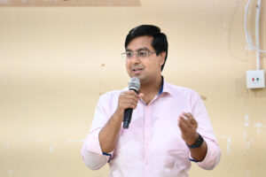
Forest and wildlife management is a highly complex process, and its complexity is increasing day by day due to the fragmentation and degradation of habitats. Human–wildlife conflicts and changes in wildlife behaviour are expected to increase in the future due to population growth and unplanned development.
More challenges lie ahead, and therefore, we must explore all possible avenues to address these emerging issues. The application of advanced technologies such as artificial intelligence (AI), drones, and Geographic Information Systems (GIS) in forest and wildlife management is highly promising and has already yielded encouraging results.
In this era of modernization, development is inevitable. Therefore, the way forward is to plan and promote sustainable development through the effective use of technology and the efficient utilization of the resources available to us.